|
|
|
|

|
Butterfly Recording Scheme for Cyprus – a request for records |
|
“Readers with an interest in the butterflies of Cyprus may well be aware that I have published distribution maps, based on UTM 10 km squares (John, E. 2000. Butterflies of Cyprus 1998 [Records of a year’s sightings] Bull. amat. Ent. Soc., Pamphlet No.15:46 pp.). The addition of records from many more sources enabled updated versions of these maps to be published in Makris 2003 (Butterflies of Cyprus. Bank of Cyprus Cultural Foundation, Nicosia). |
|
John, E. 2004. Butterfly Recording Scheme for Cyprus - a request for records. Entomologist’s Rec. J. var. Vol 116: 262. |
|
BUTTERFLY RECORDING SCHEME FOR CYPRUS: |
|
Sources of data |
|
|
|
Distribution Maps used for the CYPRUS BUTTERFLY RECORDING SCHEME are based on 5 km square and 10 km square UTM grids and are updated regularly. Please refer to the ‘Maps’ section on my News page for information on how to obtain a copy of the map produced by the Cyprus Tourism Organisation. |
|
Typical habitat of White-banded Grayling (Pseudochazara anthelea acamanthis), |
|
EXAMPLES OF 10 KM SQ. DISTRIBUTION MAPS |
|
The selected maps show the known distribution (to Nov 2005) within the entire island for the Paphos Blue (Glaucopsyche paphos), a common endemic species, compared with the far less common but also widely distributed Eastern Baton Blue (Pseudophilotes vicrama). Whereas most of the Paphos Blue records are post-2000, the map for the less frequently recorded Eastern Baton Blue relies more heavily on slightly older data. |
|
Similar maps were provided by me for the book, “Butterflies of Cyprus”, by Christodoulos Makris. Additional records are always welcomed and may be sent to: |
|
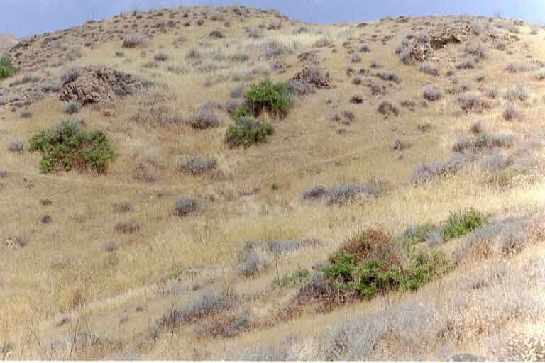
Habitat of Little Tiger Blue (Tarucus balkanicus) foothills of Troodos Mountains / Mesaoria Plain, 290 m. © Eddie John |
|
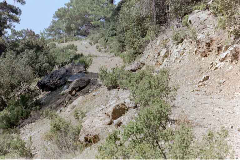
Hillside track, Mosphiloti (300 m), June 2003. Banks such as these attract a range of species, in particular The Hermit (Chazara briseis) and Cyprus Meadow Brown (Maniola cypricola) © Eddie John |
|
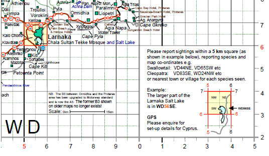
Part of my computer-prepared map showing 5 km grid UTM squares within the larger, 10 km squares. The Larnaka Salt Lake area is enlarged to show the 10 km square WD 56, within which the 5 km square WD 56SE is arrowed. |